LTFM Navdata Version 2 for non Navigraph users. If it is still needed. IF YOU ARE HAVING ISSUES, YOU CAN REMOVE IT AND TRY NAVIGRPAH INSTEAD.
I "Ali Rıza Mortas", am just a humble retired airliner who downloaded files from common platforms and in return I dared to share my files of those works for me.
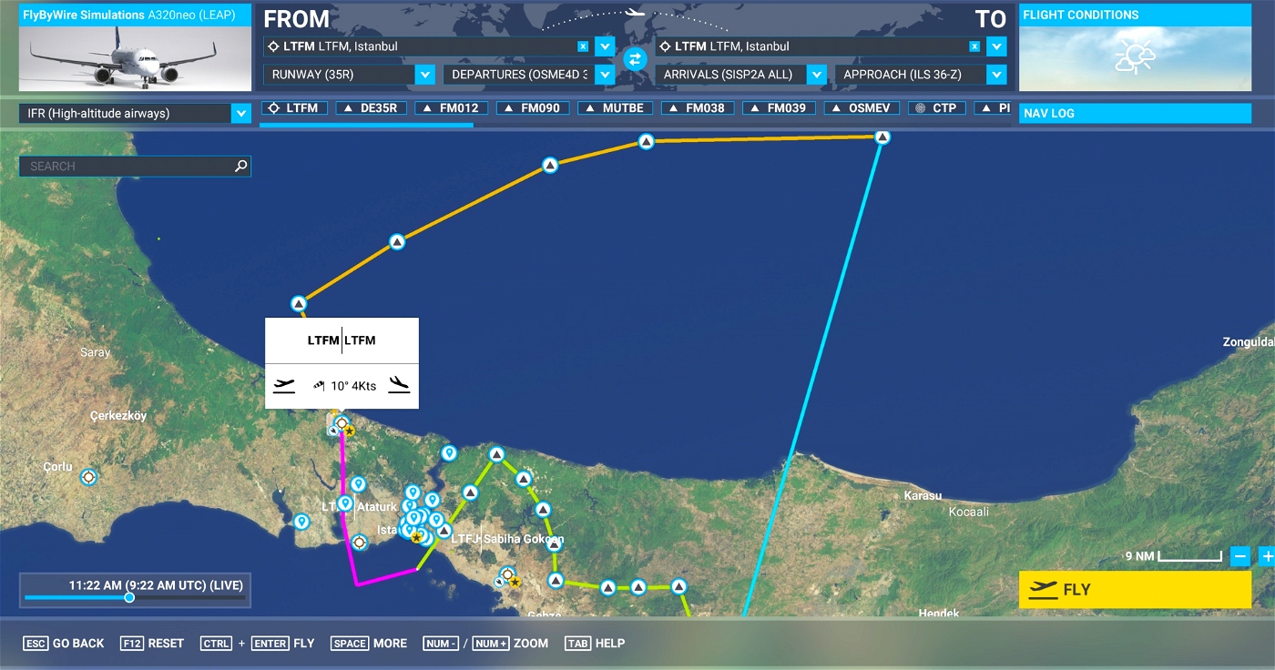
Try it, simply drag the file into your Community Folder. With this file you'll be able to select SID, STAR and ILS approach for available runways. If you are using LTFM-Navdata version 1, do not forget remove it from community folder.
If it works for you too or if you find useful then enjoy! Or else just delete it from your community folder.
I do not have Mr.Biberci & M.A.Öğüdücü Project and its runways coordinate details. I had to test and find best positions. So far, I tested for auto landings on all 6 ils runways successfully. Only +50 <> 100 feet above glide slope yet still before the last touchdown marking. See video linked.
A major issue is to enter ils frequencies manually. I do not know why but my guess is, ils data is not linked via Names under “latest SDK” to runways in LTFM scenery of Büberci & Öğüdücü. So do not forget to enter.
New transitions added, you can find under “vias”.
If you are a navigraph user please locate LTFM NavdataV2 folder after Navigraph folder, you can simply rename it such as “XLTFM-NavdataV2 otherwise Navigraph will “delete all navigations”.
If your Asobo plane does not follow navdata as expected, nothing to do. I have no idea about how Asobo or other planes work.
MSFS SDK Navdata schema has no field for “SPEED”, this file is flat navdata not an airac. Do not ask for speed.


Merci beaucoup !
2 months ago
AlfBrz
6 months ago
manuelitoo84
Hocam elinize sağlık. Bu data çok işe yaradı. Sağolun. Sizden bir de ricada bulunmak istiyorum. Mümkünse Türkiye'deki VOR'ları elden geçirmeniz. Bir çok VOR istasyonu MSFS'de çok kısa menzilli olarak simüle edilmiş. Bu da VOR yaklaşmalarda sıkıntı. Örnek: ADA, LRA, AYT, ECN.. gibi. Ben de size elimden gelen yardımı ederim.
2 years ago
Merhabalar. Teşekkür ederim. VOR'lara özet olarak (T) Terminal 1-12Bin feet arasında 25NM, (L) Low 1-18Bin feet arasında 40NM, (H) 3 irtifa kırılımına göre 40-130NM arasında erişim sağlanıyor. Siz yaklaşma sıkıntısı ifade etmişsiniz. Yaklaşma 25 NM'de Terminal area'da ise sorun MSFS'de true heading kullanılmasından olabilir. Bilemedim. Şu anda tatildeyim. Dönünce araştıracağım.
2 years ago
armortas
khakans
Hello, where can i find the airport ?
2 years ago
https://flightsim.to/file/2217/istanbul-airport
Just write LTFM in flightsim.to
2 years ago
amin
farshad